Summer weather alerts and severe thunderstorms
It’s time once again to take our annual look at severe summer weather. Let’s start off by looking at the new severe weather alerts. Environment Canada now uses a colour-coded alert system designed to make the risk levels easier to understand at a glance, but many people still treat every alert the same way.
For severe thunderstorms, a watch, shown in yellow, means conditions are favourable for severe thunderstorms to develop. The ingredients for dangerous weather are in place, but severe storms have not yet formed. There may already be thunderstorms nearby, and you should monitor conditions closely, but none of the storms have yet reached severe limits.
A warning, shown in red, means severe thunderstorms are already occurring or are imminent. Conditions such as large hail, damaging winds, torrential rain or even tornadoes have either been observed directly or detected by radar. When a warning is issued, immediate precautions should be taken.
Severe thunderstorm watches are often issued when forecasters can clearly see that the atmosphere is primed for dangerous weather, but they are uncertain exactly where storms will first develop.
Read Also

Ingredients for severe thunderstorms, part one
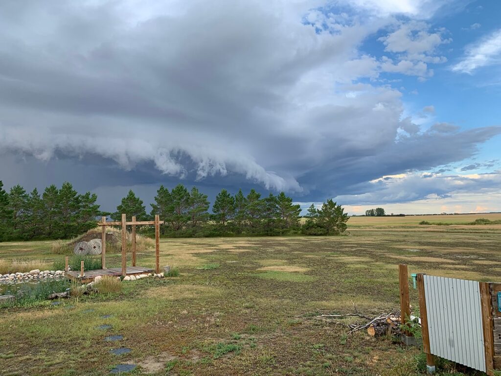
What exactly are the ingredients needed for severe thunderstorms? The first ingredient is rising air, and to get rising air you need a significant contrast in temperatures. One way this occurs is during hot summer weather, but a hot day alone is not enough. To produce thunderstorms, there also needs to be cool air higher up in the atmosphere.
When very warm air develops near the ground and cooler air exists aloft, the warm air begins to rise. Because it remains warmer than the surrounding air, it continues upward. The greater the temperature difference, the faster the air rises, and the stronger thunderstorms can become.
Not all severe storms occur on extremely hot days, however. Sometimes severe thunderstorms can develop even when surface temperatures are relatively modest. One scenario occurs when a layer of warm air develops a few thousand feet above the ground with colder air sitting above it. In this case, the elevated warm air rises upward, producing what meteorologists call elevated thunderstorms.
Another common setup involves fronts, which are simply boundaries between warm and cool air masses. When colder air pushes into warmer air, the denser cold air acts like a wedge and forces the warm air upward. This often happens along cold fronts, where thunderstorms erupt ahead of the advancing cooler air.
The opposite setup can also occur when warm air moves into a cooler region. In that case, the warm air gradually rides up and over the cooler air already in place, once again producing rising motion and thunderstorm development.
Simply having rising air and temperature contrasts is not enough to create severe weather, however. The atmosphere still needs a few more key ingredients. More on that in the next article.
Source: producer.com