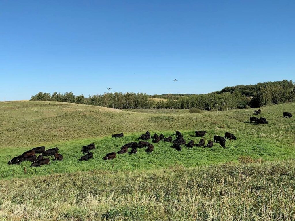
Drone technology can be used to determine cattle preferences
Precision ranching is about putting the right animal in the right place at the right time, says Edward Bork, a professor in the Faculty of Agriculture, Life and Environment Sciences at the University of Alberta.
The grazing pasture management specialist told the recent Ag Drone Summit in Camrose that the practice optimizes the level of productivity and profitability.
You can find all our coverage of the Ag Drone Summit here.
Read Also
Cutting beef and forage science is a risky experiment
Trials and studies aren’t perhaps at the forefront of most beef and forage producers’ minds, yet science, technology and innovations affect farms and ranches daily.
Bork’s talk was about cattle, but he said the same principles were applicable to any kind of livestock. He said researchers included post docs, colleagues and PhD and master’s students.
“Our job in livestock husbandry is trying to make sure that the right animal is in the right place at the right time, both to optimize their nutritional intake, but also to make sure we’re utilizing the pasture sustainably, (that) we’re not underutilizing some areas or overutilizing other areas,” said Bork, who is also director of the Rangeland Research Institute and the Mattheis Chair in Rangeland Ecology and Management.
The goal is to control where, when and how herbivores graze, to optimize economic and environmental outcomes.
“That’s what every single producer does on their ranches when they’re trying to make management decisions,” he said.
Technology is advancing so quickly that virtual fencing is a viable option.
Habitat selection
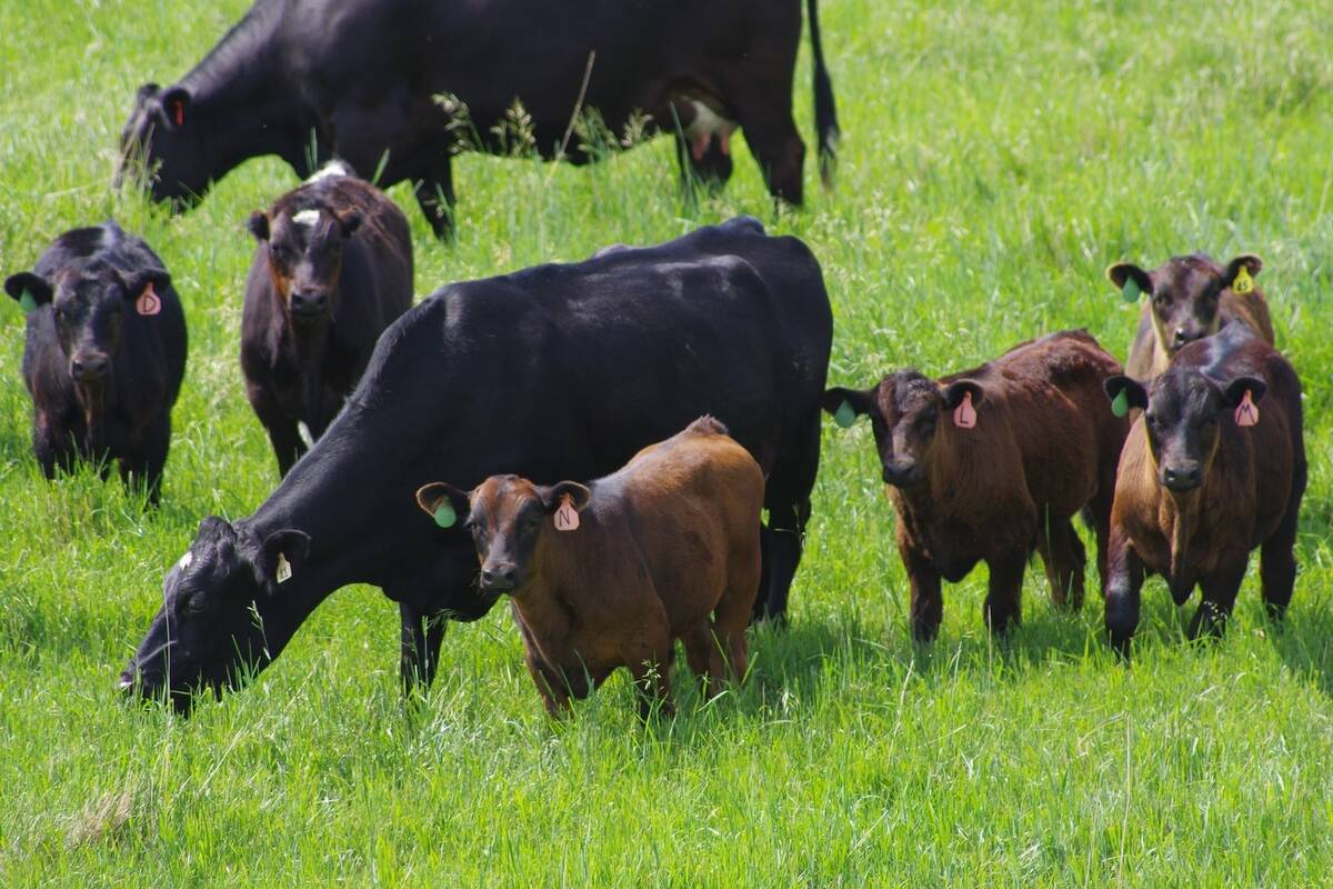
Identifying animals with an improved ability to select habitats available on a ranch can make a difference in animal productivity.
“If you’re in the boreal forest and 80 or 90 per cent of what you’re grazing is bush pasture, you might want an animal that is able and willing to utilize your aspen forest more effectively,” he said.
Those animals can be identified by their dietary or habitat selection.
“These are the ones we’re going to keep, and we’re going to try to cull out the other ones,” said Bork.
Habitat mapping
Bork spoke about habitat mapping at the Kinsella research ranch.
Most conventional satellites are equipped with multi-spectral scanner data, which is basically RGB imagery.
“We can put those platforms onto drones, or UAVs, and we can collect a lot of information on that. However, we also have the advantage with drones to be able to collect light detection and ranging data. This is essentially laser-based data,” he said.
The laser-based platform can provide a three-week contour of the surface of the ground and everything above ground. This can be used to develop high resolution digital elevation models, which can be used for habitat mapping, or potential of disturbance.
“If you increase stocking rate or if you leave animals in for a longer period of time, you could potentially map out changes in forage biomass,” he said.
Using LIDAR and multispectral data, Bork and his associate Jason Su were able to produce a high-resolution map of the Kinsella research ranch. The map showed eight or nine different habitat types.
Drones can be used to fly over an area to produce high resolution habitat maps that can determine grazing capacity or structuring grazing patterns to look at habitat behaviour patterns on the landscape.
Habitat diversity and animal welfare
Bork said he has been working with researchers to see how habitat diversity contributes to animal welfare.
The project ran for three years, using low tech GPS collars.
“While we use low tech collars here, we have subsequently learned that the Nofence collars give us GPS data that is every bit as good at roughly one-fifth of the cost,” he said.
In the future, Bork intends to use only virtual fencing collars.
The study looked at cows and heifers during summer grazing and fall grazing regimes. Data was analyzed from a cluster of data points taken from the GPS collars and superimposed on the high-resolution habitat map.
The researchers could compute whether animals avoided or preferred different habitats.
Bork said the team measured habitat electivity response, which measures if animals are seeking out a habitat and using it at a higher level than they would if they were using that habitat randomly. If electivity is around zero, it means the habitat is randomly selected. If the electivity is below zero, it means cattle are actively avoiding the habitat.
Preferred habitats
Bork said the data showed cattle at the Kinsella ranch preferred the uplands, grasslands and wetlands.
“It makes sense. Those are the most productive areas. There’s a lot of herbage in there. Forage efficiency is going to be high. It makes sense that those are the areas that they prefer, but those are the areas targeted largely in the summertime,” he said.
In the fall, even though animals were moved to a new pasture, they still preferred the wetlands. They also gravitated to the open shrublands.
“They started exhibiting some changes in their habitat selection patterns. There was no difference between cows and heifers,” he said.
“Wetlands were the only habitat that was consistently preferred, which is one of the reasons why grazing management specialists always talk about making sure you manage your wetlands carefully because they’re going to be targeted over and over,” he said.
Tracking the animals through early July, late July, early August and late August determined that they changed their preferences over time. They gradually reduced their use of the upland grasslands and wetlands and gradually increased their use of the open shrublands.
“They’re gradually changing over time, likely in concert with changes in phenology and biomass availability,” he said.
Heat and cold stress
The researchers wanted to see what habitats cattle preferred during heat stress, conducting the study in 2021, when there were 16 days warmer than 30 C in central Alberta with several of the heat events lasting four or five days.. There are normally only two days warmer than 30 C near Edmonton.
“We took days with these extreme temperatures and compared electivity patterns to days without the elevated temperatures,” said Bork.
The researchers also look at the humidex index, which is the potential heat stress concern for the public.
Bork said animals did change their electivity patterns during extreme heat. They reduced their use of specific habitats, particularly the open shrublands but started moving into a deliberately selected wooded environments, particularly forests.
The cattle were doing this to reduce their heat stress.
“Forests are generally avoided because they don’t offer a high amount of forage,” said Bork.
However, in the hottest part of the day, the animals hid in the forest to reduce their heat stress.
Cold stress is another factor for habitat selection. In the fall of 2022, the researchers grazed their native pastures all the way through until Nov. 10. Early November featured extreme wind chills, deep snow, cold temperatures and strong winds.
During days of cold stress, animals reduced their use of open shrublands and grasslands.
“Anyone who knows livestock behaviour will know that on those really cold days, it gets to a point where they just don’t want to be in the open. They will go seek any kind of cover, but you have to have that cover for them to be able to alleviate their temperature stress,” he said.
The cattle selected the shrublands and the aspen forest to relieve themselves from cold stress.
“Even though aspen forests and some of these closed shrublands may be less productive and the forage less accessible, they’re still important. Now, as a producer, you might maintain five per cent of them, or 10 or 20 per cent of them. Every producer is going to have a different rule of thumb, but I would suggest these habitats are worth keeping around, even if it’s only on a limited basis.”

Source: producer.com